Walkability Chapter 1: Introduction
Categories:WalkabilityAI/ML
Introduction
Walkability is an urbanist concept referring to how easy and desirable it is to walk in a given place, with considerations of the physical environment and the human individual. Typically, to estimate “walkability indices”, theoretical urbanist frameworks extend beyond the factors related to pedestrian temporal efficiency and leverage physical elements such as greenery, public amenities, or other common geospatial information. Despite that, pedestrian path-finding frameworks, which have been around for several decades and are relied upon by millions of users every day, generally ignore any such notions described in the urbanist literature. Instead, these frameworks typically aim to maximize simplistic objectives, most commonly the estimated duration to undertake a path, or even only the path’s overall length. From the urbanist standpoint, however, these metrics represent only a subset of the factors that determine whether someone chooses to walk or selects an alternative mode of transportation. This problem is further amplified by the fact that existing routing frameworks either entirely preclude user-defined preferences or allow them only through highly complicated and constrained configuration files.
In this work, we study and answer three questions essential to accurately addressing the issues imposed by the methodologies used in popular path-finding frameworks:
-
Shortcomings of existing path-finding: What are the implications of using preference inflexible, time efficiency-focused path-finding algorithms, particularly through the lens of walkability? Why are the path-finding frameworks so inflexible to specific user needs?
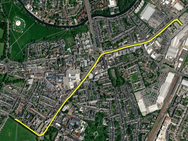
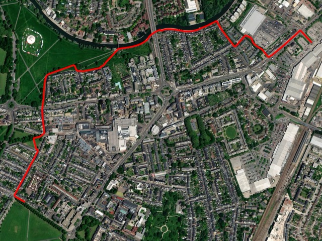
To answer these questions, we assemble a corpus of five realistic routing scenarios within the boundaries of the city of Cambridge, UK, discuss the unifying nature of solutions generated by three popular open-source frameworks, and identify potential improvements and missed routing opportunities. Furthermore, we discuss the definitions of preferences used to generate these outputs, and highlight their complexity and poor accessibility.
-
Improving the quality of path-finding solutions: How can urban path-finding be reoriented towards the concepts of walkability? Furthermore, how can path-finding frameworks respond more receptively and comprehensively to specific user requirements and preferences?
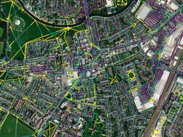
We provide solutions to these issues with two novel contributions. First, we present a computationally efficient tool for automated assessment of walkability in urban areas. We leverage modern natural language processing models (particularly our custom fine-tuned transformer-based sentence encoders) and a knowledge base aggregated from public geospatial datasets, primarily the OpenStreetMap. By utilizing rich semantic embeddings, our method significantly improves upon state-of-the-art (generally computer vision-based) walkability assessment methods. Second, building on the acquired assessment tool, we present a new pedestrian path-finding framework based on the A* search for the generation of pedestrian routes according to the urbanist walkability principles.
Finally, we leverage our semantically-based pipeline to develop an approach for embedding nuanced pedestrian objectives reflective of real-world scenarios into path-finding solutions.
-
Simplifying user inputs: What alternative approach to routing configuration files can be leveraged to simplify the process of inputting specific preferences?
Lastly, to address this problem and provide a simplified way to define user-specific pedestrian preferences, we leverage sentence encoders’ ability to extract semantic associations. As our walkability assessment component is based on the use of sentence anchors (which are utilized as points of reference for specific qualities and “levels” of walkability), our pipeline is also able to reflect user-specific preferences projected into these anchors. This approach allows not only for very loosely constrained preference definitions, but also their straightforward representation (as they can be defined with natural language).
To evaluate our approach, we follow the order of the above questions and analyze the problem and our solution on the aforementioned corpus of routing scenarios. For this purpose, we also conceive four realistic sets of pedestrian preferences (in addition to the general walkability preference) that aim to maximize the presence of historical, green, shopping, and public safety-oriented elements in their respective path-finding solutions. We employ these preferences in the assessment component to compile unique walkability maps, and then use these maps in our path-finding algorithm to generate highly walkable and specific-objective maximizing paths.